
Victoria’s coastal towns are at risk of flooding, and these ‘potholes’ are partly to blame
One of the state’s most popular holiday spots is battling rising sea levels and increasing storm surges, with ageing flood defences struggling to keep the tides at bay.
First reported 2 hours ago · latest update 2 hours ago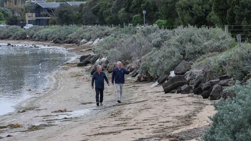
Anyone strolling the raised track beside the Barwon River Estuary’s glassy waters may hardly notice they are walking on a flood defence system.
Built in the 1970s, the levee protects the Riverview Family Caravan Park in Ocean Grove that hosts thousands of holidaymakers during peak periods, as well as some nearby houses.
But much like Victoria’s road network after heavy rain, the protective wall is vulnerable to potholes from repeated water exposure – especially so after storm surges and high tides.
Soon this defence and many others like it across the state may not be enough to protect the coastline from myriad threats: coastal erosion, sea level rise, stormwater flooding and other climate change-related challenges.
Barwon Coast Committee of Management chief executive Gareth Smith said a small hole left unpatched could result in a serious problem later in the levee.
“They can get bigger if not addressed and compromise the levee’s structural integrity,” he said.
Earlier this year, Barwon Coast released a report identifying the caravan park on the river’s eastern shore as a hotspot for coastal inundation.
Smith said the levee’s height was uneven, with about half a metre’s difference between its lowest and highest points.
The report said the levee is partially breached at low points today, and forecast it would be fully inundated by 2100 under current sea level rise scenarios.
Now, the Department of Energy, Environment and Climate Action is preparing to bolster the levee defence system. It has received $250,000 in federal government funding to undertake a flood study and adaptation plan that will inform the design of flood mitigation infrastructure at the Riverview Caravan Park.
A department spokesperson said the process to procure a consultant who will undertake the study would begin in coming weeks.
“We know how important it is to protect coastal communities from flooding and rising sea levels, which is why we’re investing in the work needed to identify long-term solutions for Riverview Caravan Park,” the spokesperson said.
The department provided funding in 2024 to undertake repairs to the revetment wall, which is part of the levee flood defence.
Smith said caravan parks are often on the front line against coastal and flooding threats because many are located near beaches and along river banks.
“They’re often in lower-lying areas, which are at highest risk too.”
Until the 1970s, the eastern shoreline along the Barwon River was a mangrove swamp. It was then developed into a caravan park, protected by the levee that remains today.
Replanting mangroves might form part of the plan to protect the area. Smith said this could help reduce future erosion because the mangroves’ root structure helps hold soil together – even though it won’t address sea level rise.
Communities are facing similar challenges not only throughout neighbouring areas, but across the state and around the country too. Around the world, coastal communities are grappling with similar problems.
In Ocean Grove, the caravan park includes about 500 accommodation sites, so protecting it is crucial to its future.
As one of the state’s most popular holiday destinations, Barwon Coast receives about half a million visitors every year.
The City of Greater Geelong has recently undertaken flood mapping in the catchment across Ocean Grove, Central Geelong, South Geelong, Highton and Waurn Ponds to determine risk and guide future drainage investment.
The mapping showed extensive risk of stormwater flooding throughout the suburbs.
Geelong mayor Stretch Kontelj said the city manages more than 2450 kilometres of drainage infrastructure and understood where improvements were needed.
But he acknowledged the council alone could not meet the investment required to tackle major flooding, update ageing infrastructure and strengthen the stormwater network.
Kontelj urged the state government to review Geelong’s stormwater management model and join the council in delivering long-term solutions to reduce flood risk.
In the small hamlet of Breamlea, near Ocean Grove, water from the swollen Thompson Creek sat less than a few metres from the road last week after heavy rain.
Although the nearby houses were not at risk, the flooding threat to the road raises questions about car access during emergencies.
Less than 30 kilometres away, as the crow flies, the Mornington Peninsula Shire has called for funding to restore the Portsea front beach, where erosion has washed away the shoreline.
The state government has opened community consultation on long-term management options, which includes replacing an existing geotextile seawall installed in 2010, but that has reached the end of its life. Other options include constructing an elevated boardwalk, a wave screen and a rock groyne extending from the shore into the water to reduce wave impacts.
Revegetating the upper dune at Portsea is a feature of all the options.
At Inverloch on the Bass Coast, the Department of Environment, Energy and Climate Action has carried out extensive sand dredging and beach renourishment to protect the coastline and human-made structures from erosion.
Bass Coast Shire mayor Brett Tessari said the works had temporarily protected the coastal road at Inverloch and surf life-saving club, but other areas were also under threat.
“We’ve got issues across the Bass Coast,” he said.
Start the day with a summary of the day’s most important and interesting stories, analysis and insights. Sign up for our Morning Edition newsletter.
You have reached your maximum number of saved items.
Remove items from your saved list to add more.
You've used all of your gift articles. 3 more will become available on the 1st of every month.
Citations · 2 reports from 2 outlets
Tap a citation to read it above, right here on T.A.M.
Victoria’s coastal towns are at risk of flooding, and these ‘potholes’ are partly to blame
One of the state’s most popular holiday spots is battling rising sea levels and increasing storm surges, with ageing flood defences struggling to keep the tides at bay.
2 hours ago · Benjamin PreissVictoria’s coastal towns are at risk of flooding, and these ‘potholes’ are partly to blame
One of the state’s most popular holiday spots is battling rising sea levels and increasing storm surges, with ageing flood defences struggling to keep the tides at bay.
2 hours ago · Benjamin Preiss